
 Алгебра
 Английский
 Биология
 География
 Геометрия
 История
 Русский
 Обществознание
 Физика
 Химия
Химия Информатика
 Литература
 Математика
Вопрос:
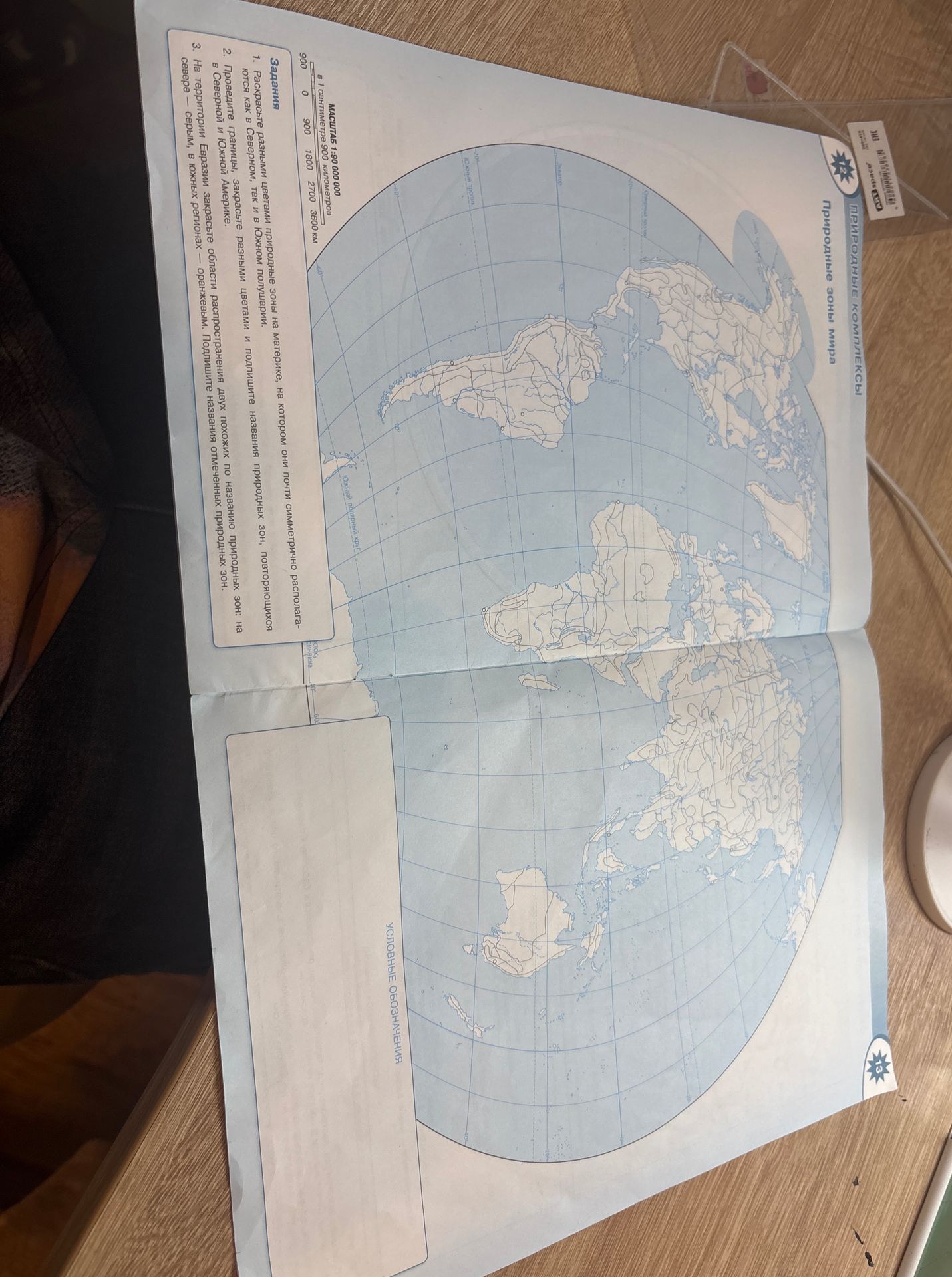
Analyze the provided image and extract all textual information, including any instructions, labels, and map details.
Ответ:
Map Details:
- Title: Природные комплексы. Природные зоны мира.
- Scale: 1:90 000 000 (в 1 сантиметре 900 километров)
- Latitude Lines: Marked at intervals, including the Equator (Экватор), Tropic of Cancer (?), Tropic of Capricorn (Южный тропик), and Antarctic Circle (Южный полярный круг).
- Longitude Lines: Marked at intervals, with a Prime Meridian line indicated.
- Geographic Features: Outlines of continents are shown, with internal lines possibly representing borders or natural divisions.
- Labels: Some labels are present but partially obscured or difficult to read due to image quality and rotation. Examples include 'Океан', 'тропик', 'полярный круг'.
- Legend: A section labeled 'УСЛОВНЫЕ ОБОЗНАЧЕНИЯ' (Conventional Symbols) is present but empty.
Instructions for Tasks:
- Задания (Tasks):
- 1. Раскрасьте разными цветами природные зоны на материке, на котором они почти симметрично располагаются как в Северном, так и в Южном полушарии. (Color the natural zones on the continent where they are almost symmetrically located in both the Northern and Southern hemispheres.)
- 2. Проведите границы, закрасьте разными цветами и подпишите названия природных зон, повторяющихся в Северной и Южной Америке. (Draw the borders, color, and label the names of natural zones that repeat in North and South America.)
- 3. На территории Евразии закрасьте области распространения двух похожих по названию природных зон: на севере - серым, в южных регионах - оранжевым. Подпишите названия отмеченных природных зон. (On the territory of Eurasia, color the areas of distribution of two natural zones with similar names: in the north - gray, in the southern regions - orange. Label the names of the marked natural zones.)
Additional Information:
- There are some handwritten marks or annotations on the image, particularly on the left side.
- A small sticker with a barcode and some text is visible in the upper right corner.
- The map appears to be part of a textbook or workbook.
