
 Алгебра
 Английский
 Биология
 География
 Геометрия
 История
 Русский
 Обществознание
 Физика
 Химия
Химия Информатика
 Литература
 Математика
Вопрос:
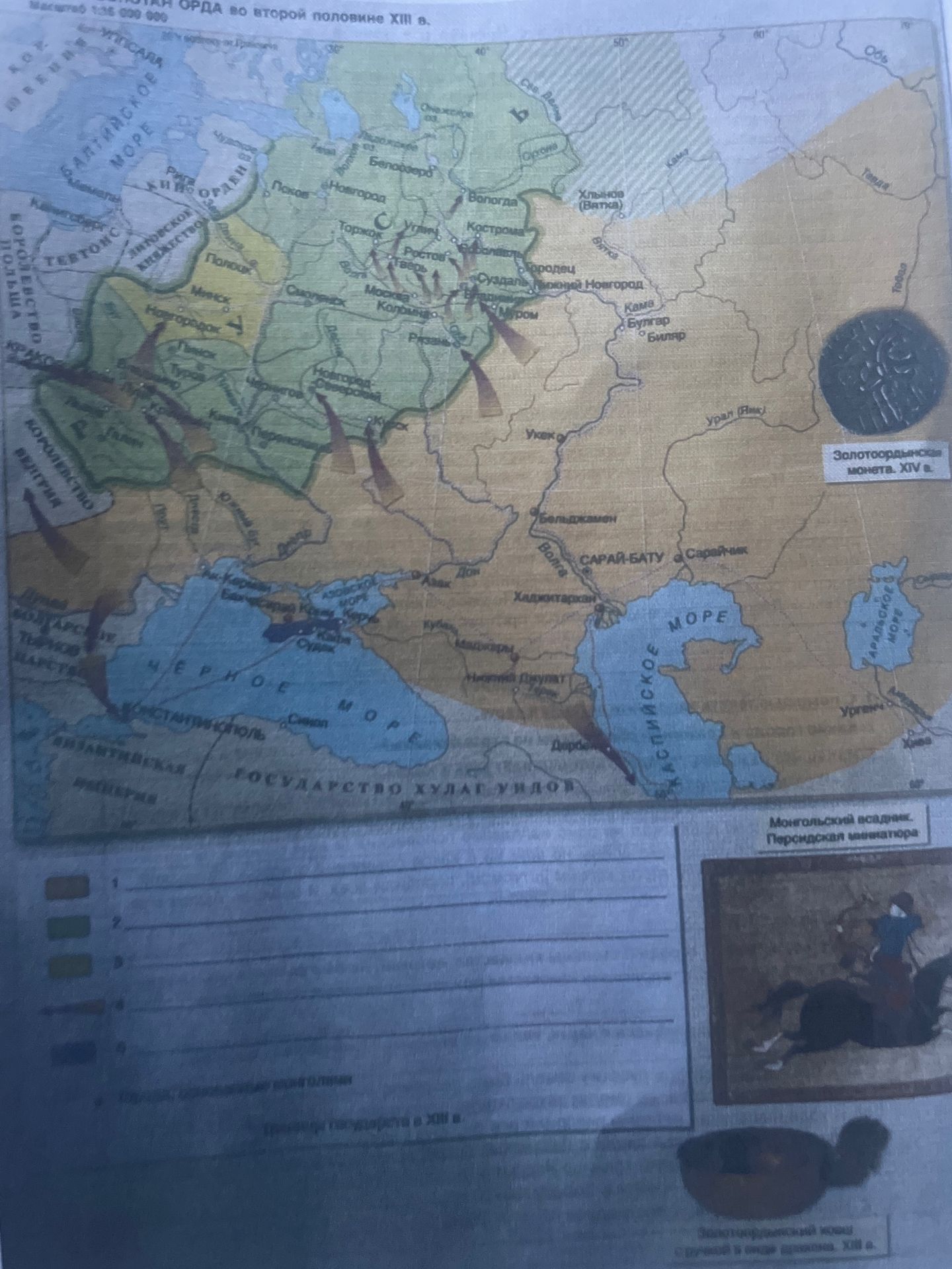
Map of the Golden Horde in the second half of the 13th century.
Ответ:
Analysis of the map:
The map shows the Golden Horde in the second half of the 13th century. It illustrates the vast territory controlled by the Golden Horde, including major cities and surrounding regions. The map also depicts areas of influence of neighboring states and the routes of military campaigns, indicated by arrows.
Key areas and features on the map:
- Golden Horde territory: Marked in yellow and light brown, covering a large part of Eastern Europe and Western Asia.
- Major cities: Sarai-Batu, Saraychik, Bulgar, Bolghar, Ukek, Khadzhitarkan, and others are indicated.
- Neighboring states: Kingdom of Poland, Kingdom of Hungary, Byzantine Empire, Sultanate of Rum, Grand Duchy of Lithuania, Novgorod, Vladimir-Suzdal Principality are shown with different colors or borders.
- Seas: Black Sea, Caspian Sea, Sea of Azov, Baltic Sea are labeled.
- Rivers: Volga, Kama, Ural, Don, Dnieper, Danube are prominent geographical features.
- Military campaigns: Arrows suggest movements and invasions, particularly towards the west and south.
- Inscriptions: The map includes inscriptions in Russian, identifying geographical locations, states, and historical periods. For example, "Золотоордынская монета. XIV в." (Golden Horde coin. 14th century) and "Монгольский всадник. Персидская миниатюра" (Mongol rider. Persian miniature) provide context and visual cues about the era.
The legend indicates different colors representing different entities or areas, numbered 1 to 4, but the specific meaning of each number is not fully legible in the provided image.
