
 Алгебра
 Английский
 Биология
 География
 Геометрия
 История
 Русский
 Обществознание
 Физика
 Химия
Химия Информатика
 Литература
 Математика
Вопрос:
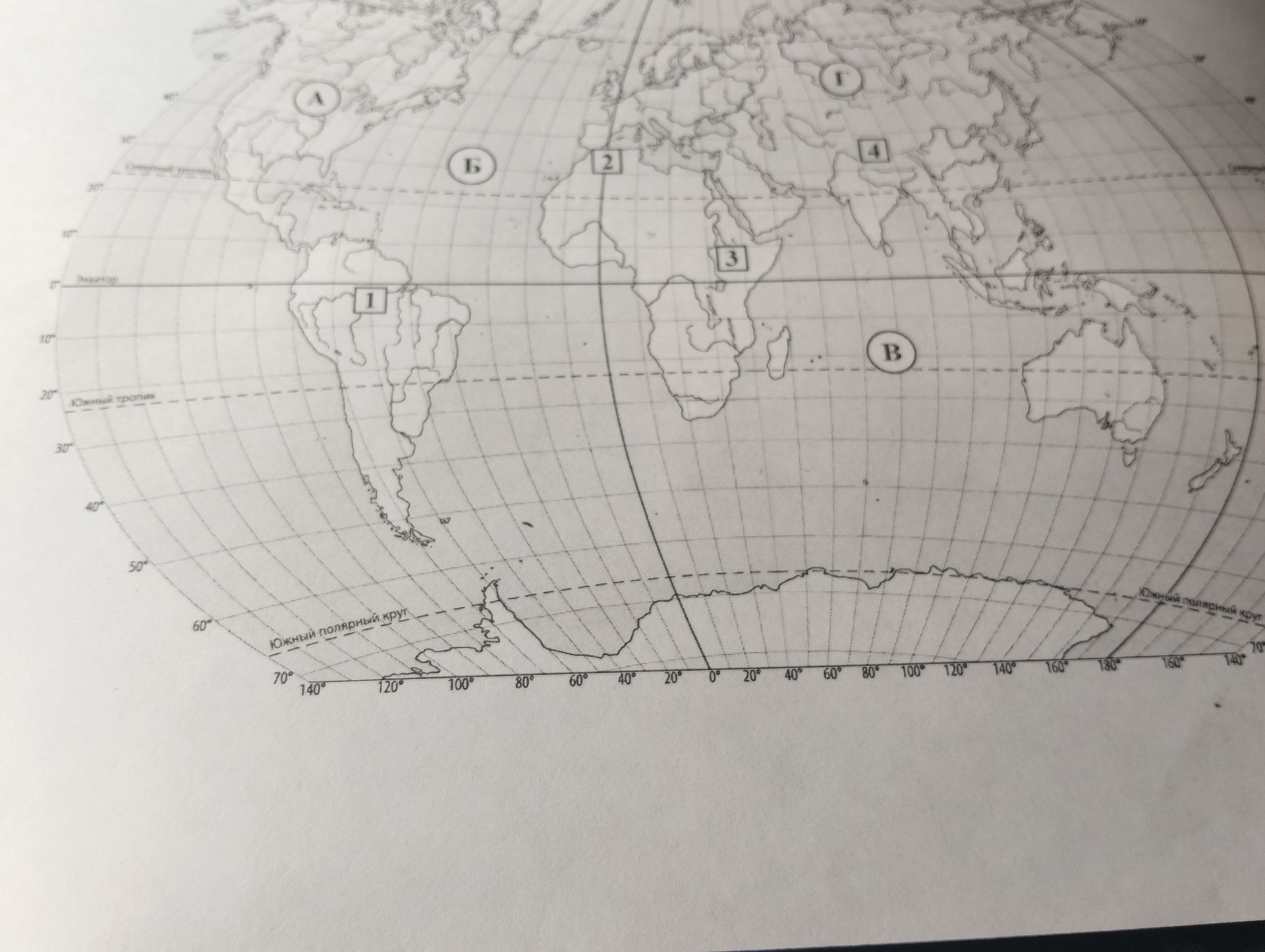
The provided image is a world map with several numbered and lettered regions. Identify the continents or major geographical areas represented by the numbers 1, 2, 3, 4 and letters A, B.
Ответ:
Analysis of the World Map:
- Region 1: Located in South America, this region encompasses the vast majority of the continent, including the Amazon basin and the Andes mountains. It represents South America.
- Region 2: Situated in the northern part of Africa and extending into the Middle East, this region appears to cover North Africa and parts of the Arabian Peninsula. It represents North Africa / Middle East.
- Region 3: Located in Central and Southern Africa, this region covers a significant portion of the African continent south of the Sahara Desert. It represents Central/Southern Africa.
- Region 4: Positioned in Asia, this region covers a large part of the continent, including India, Southeast Asia, and parts of China. It represents South/Southeast Asia.
- Region A: Located north of South America and west of Europe/Africa, this region clearly represents North America.
- Region B: Situated southeast of Asia and west of the Pacific Ocean, this region represents Australia.
Conclusion: The map divides the world into distinct geographical zones, likely for study purposes, highlighting major continents and sub-continental regions.
