
 Алгебра
 Английский
 Биология
 География
 Геометрия
 История
 Русский
 Обществознание
 Физика
 Химия
Химия Информатика
 Литература
 Математика
Вопрос:
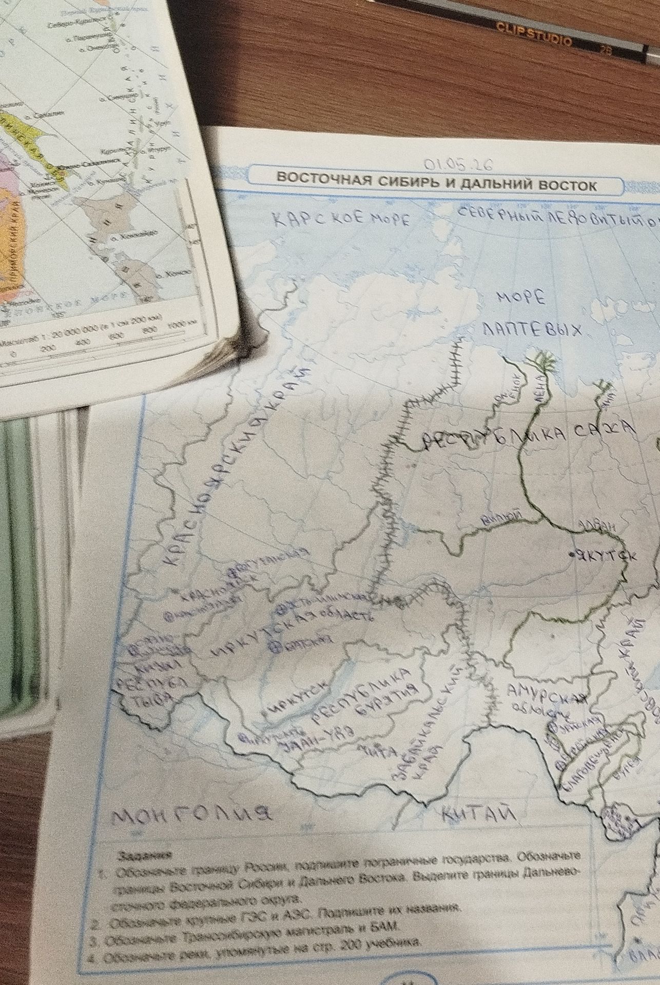
Using the map, identify and label the following features: Northern Sea Route, Laptev Sea, Kara Sea, Lena River, Republic of Sakha, Irkutsk Oblast, Amur Oblast, Trans-Siberian Railway, BAM Railway, Mongolia, China.
Ответ:
Analysis of the Map:
The map displays Eastern Siberia and the Far East. Based on the provided image and the labels present, here are the identified features:
- Northern Sea Route: Indicated by a dotted line along the northern coast.
- Laptev Sea (МОPE ЛАПТЕВЫХ): Labeled north of the Republic of Sakha.
- Kara Sea (КАРСКОЕ MOPE): Labeled to the west, bordering the Republic of Sakha and Krasnoyarsk Krai.
- Lena River: Indicated by a blue line flowing through the Republic of Sakha and emptying into the Laptev Sea.
- Republic of Sakha (РЕСПУБЛИКА САХА): A large region labeled in the northeastern part of the map.
- Irkutsk Oblast (ИРКУТСКАЯ область): A region located to the south of the Republic of Sakha.
- Amur Oblast (АМУРСКАЯ область): A region in the southeastern part of the map.
- Trans-Siberian Railway: Represented by a solid green line running from west to east, passing through Irkutsk and heading towards the Amur Oblast.
- BAM Railway (БАМ): A railway line running parallel to the Trans-Siberian Railway for a significant portion, also indicated by a green line.
- Mongolia (МОНГОЛия): Labeled to the south of Irkutsk Oblast and the Republic of Buryatia.
- China (КИТАЙ): Labeled to the south of the Amur Oblast and Zabaykalsky Krai.
Note: Some labels are handwritten and may require interpretation. The specific locations are identified based on their proximity to other labeled features and geographical context.
