
 Алгебра
 Английский
 Биология
 География
 Геометрия
 История
 Русский
 Обществознание
 Физика
 Химия
Химия Информатика
 Литература
 Математика
Вопрос:
What are the geographical features and instructions mentioned in the image?
Ответ:
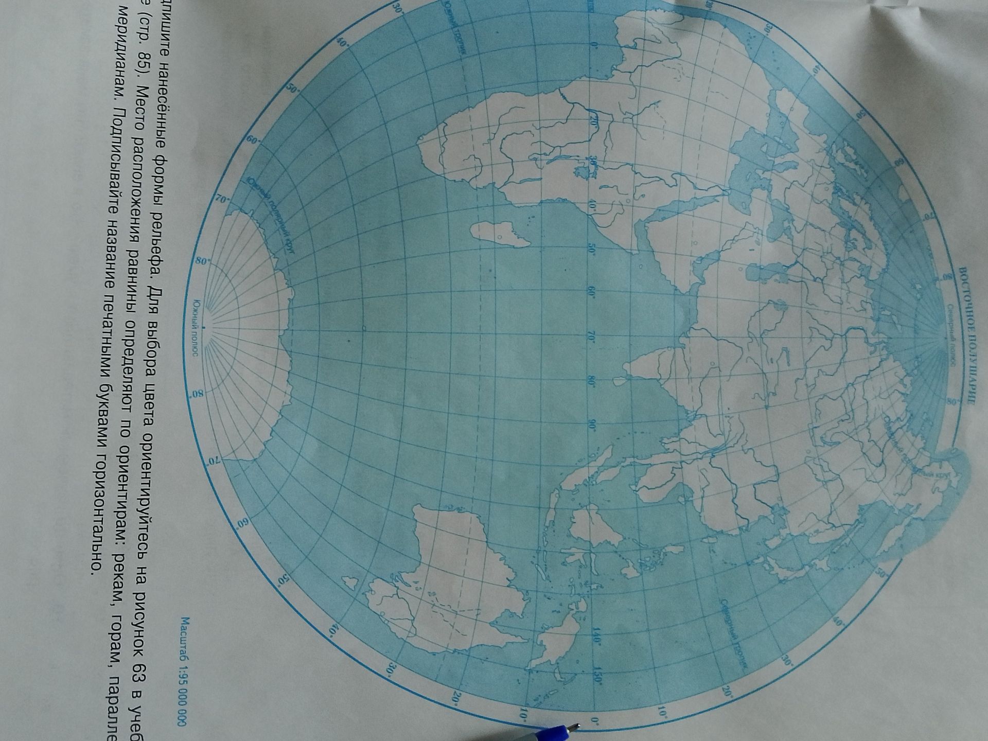
The image displays a world map with grid lines representing latitude and longitude. The text in Russian provides instructions related to geography:
- Instructions: "Подпишите нанесённые формы рельефа. Для выбора цвета ориентируйтесь на рисунок 63 в учебнике (стр. 85). Место расположения равнины определяют по ориентирам: рекам, горам, параллелям и меридианам. Подписывайте название печатными буквами горизонтально."
- Translation: "Label the applied relief forms. To choose the color, orient yourself by figure 63 in the textbook (page 85). The location of a plain is determined by landmarks: rivers, mountains, parallels, and meridians. Label the name in block letters horizontally."
- Scale: "Масштаб 1:95 000 000" (Scale 1:95,000,000).
- Geographical terms:
- "Южный тропик" (Tropic of Capricorn)
- "Южный полярный круг" (Antarctic Circle)
- "Южный полюс" (South Pole)
- "Северный полюс" (North Pole)
- "Восточное полушарие" (Eastern Hemisphere)
- "Северный тропик" (Tropic of Cancer)
- "Северный Ледовитый океан" (Arctic Ocean - implied by location)
The map shows continents and bodies of water, with latitude lines marked from 0 to 90 degrees North and South, and longitude lines indicated from 0 to 180 degrees East and West.
