
 Алгебра
 Английский
 Биология
 География
 Геометрия
 История
 Русский
 Обществознание
 Физика
 Химия
Химия Информатика
 Литература
 Математика
Вопрос:
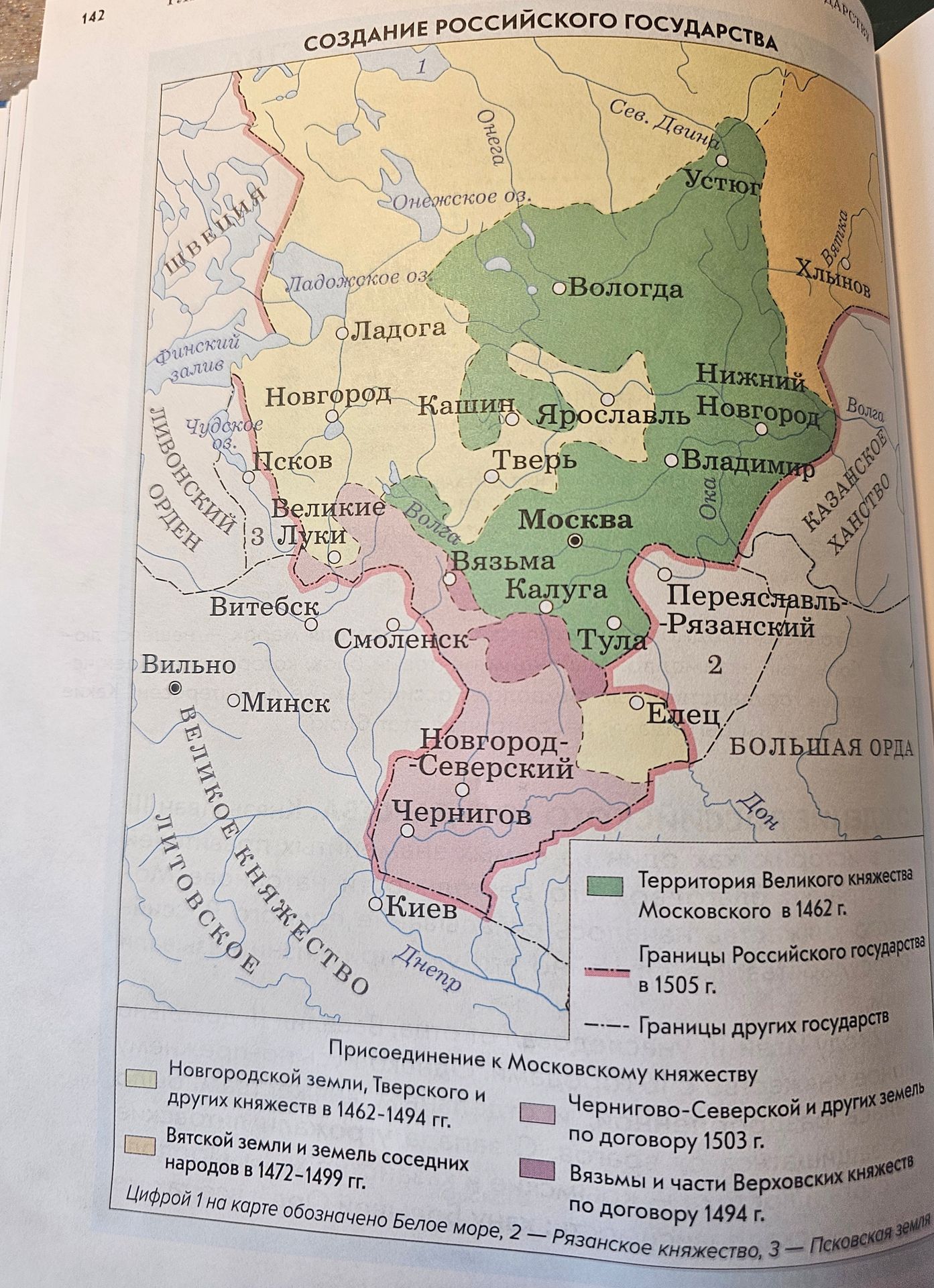
What does the map depict?
Ответ:
This map depicts the creation of the Russian state, showing territories and borders at different historical periods. It illustrates the expansion of the Grand Duchy of Moscow and the consolidation of Russian lands.
Key elements shown on the map include:
- Territory of the Grand Duchy of Moscow in 1462.
- Borders of the Russian state in 1505.
- Borders of other states.
- Territories annexed to the Moscow principality at different times:
- Novgorod lands, Tver, and other principalities (1462-1494).
- Vyatka lands and neighboring peoples (1472-1499).
- Chernigov-Seversk lands and others (by treaty of 1503).
- Vyazma and parts of Verkhovskiye principalities (by treaty of 1494).
- Geographical features such as lakes (Ladoga, Onega, Chudskoye), rivers (Volga, Oka, Dnieper, Don, Northern Dvina), and gulfs (Finnish Gulf).
- Major cities and regions, including Moscow, Novgorod, Tver, Kazan Khanate, Golden Horde, Great Lithuanian Principality, and Sweden.
- Specific numbered locations: 1 - White Sea, 2 - Ryazan Principality, 3 - Pskov land.
